


| ILOCOS NORTE:"A CULTURAL AND HISTORICAL SPOT" |
|
|
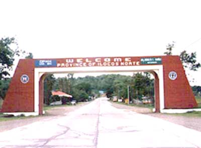
At the time of the Spaniards, there was already a region known as Ilocos, with Vigan as the capital. Centers of population seem to have been in Lapog and Vigan. The Spaniards created this province into the province of Ilocos, Vigan as the capita, but by a royal decree of 1818, the northern part was separated and erected into the province called Ilocos Norte. To the new province was assigned the following towns: Bangui, Nagpartian, Pasuquin, Bacarra, Vintar, Sarrat, Solsona, Marcos, Paoay, Banna, Batac, Nueva Era, Pagudpud, Piddig, Dingras, Laoag, and San Nicolas. At the time Ilocos Norte was made a province, the towns mentioned had a population of 135,748. Spanish exploration of Ilocos begun as early as 1572, when Juan de Salcedo made his famous trio along the Ilocos coast. During his trip, he visited what is now Ilocos Norte, occupying Laoag, which even then seems to have been the chief center of population of the region. He explored the mouth of the Laoag river and had several encounter with the hostile natives. He also sent a punitive expedition to a town called "Bacal", probably the present town of Batac. The King of Spain Ferdinand VII created Ilocos Norte as a separate province by a royal decree in 1818 and he made Laoag its capital. Before this, the coastal region encompassing both Ilocos Norte and Ilocos Sur was one province, Ilokos or Ilocos. La Union was part of Pangasinan. Agoo, however, was an Ilocano settlement, attesting to the southward movement of the Ilocos population. Before there were provinces or alcaldias, there were "cities" like Vigan, pueblos or municipalities and cabeceras or towns. It was in the thriving, populated towns where the first churches were built and the Spanish-Mexican tradition in town planning implated on Philippine soil to create what is now known as the church -plaza complex. Around the complex which would also include the offices and residences of officialdom, the town clustered and grew. Ilocos Norte occupies the whole of the coastal plain in the northwestern corner of Luzon, the Cordillera del Norte, which separated it from Abra and Cagayan, extends along the eastern border along the China Sea in the North. Along this range, the highest peaks are Sinninublan, Sicapco, Licud, Dinawanang, and Quilang. The coastline is so regular that although there are several ports such as Gabut, Laoag, Bangui, Diriqui, and Currimao, the last is the only one which offers any protection from the north winds. Ilocos Norte is in the northern tip of Luzon, Philippines. It is wedged between the steep Gran Cordillera Cnetral in the east, the rugged Ilocos Mountains in the northwest and the Ilocos Range in the south. In the west is the South China Sea. Its plains mainly of alluvial deposits are traversed by 3 great rivers - Padsan (now Laoag), Bacarra and Badoc, that originate from the Cordillera and Ilocos Mountains. Fed by the rivers and rainwaters, the Ilocos plains and low-lying hills are agriculturally suitable to rice, corn, and vegetables and to cash crops like tobacco, garlic, cotton, and sugarcane. The vast Ilocos forest and mountain fringes abound in wild game and products like hardwood, bamboo, rattan, bees wax, and honey. There are metallic deposits like manganese, iron, ore, copper, magnetite sand, gold and silver. Non-metallic resources include limestone, guano, asbestos, sand, cola and feldspar. Climate is generally warm and dry. The hottest months are from March to May when temperature reaches 32oC. From November to February however, the days are windy and morning dip to chilly 22oC. Th rest of the year from June to October are wet, rainy and stormy. The average annual precipitation is 3,000 millimeters. With a cost line that stretches to 90 statute miles, Ilocos Norte is blessed with rich marine life - shells, giant turtles, seaweeds, starfishes, tuna and variety of fishes. Ilocos Norte belongs to the original Ilocos provinces - the others are Ilocos Sur and La Union. It is the home of some 390,666 Ilocanos who speak the Iloko language that has become the lingua franca of entire Northern Luzon. Nestled in narrow plains between precipituous mountains and the expansive sea the Ilocanos are fishermen, farmers, and hunters all in one. Masters of both land, sea and inland waters, they are sturdy, hardy and persevering. The hardiness of the people often been compared to the Pamulinawen - green colored stone that abounds in Ilocos Norte river beds. But above all, the Ilocanos are freedom loving having resisted with heroic valiance conscriptive edicts and occupation of colonial powers. Most notable of these resistance movements are: Basi Revolt, Revolts against the Tobacco Monopoly, the Sarrat Revolt, the Aglipay religious secession, the Resistance to American aggression and Japanese occupation. Ilocos Norte has 23 municipalities with a total 533 barangays. As of the 1995 census, the province has a total population of 482,651. In the year 2000, the Province of Ilocos Norte, the northernmost node of development for the Northwestern Luzon Growth Quadrangle, shall have realized its full potential as the northern gateway to the full-fledged economic dragons of Hongkongs, Taiwan and the phenomenal strip of Southern China where the special economic zones have been set-up Ilocos Norte shall have successfully emerged from the debilitating power traps of a highly polarized political leadership and citizenry. Enlightened political personalities shall have closed ranks sectors to vigorously push the economic development of the province. Agro-industrialization of the provincial economy shall have proceeded at an accelerated pace. Tourism shall have played a key role towards the development of the province. Tourist related industries in the province shall have reached their full potential owing to the influx of tourists. Laoag, with its strategic location vis to vis Taiwan and Southern China, shall have cornered much of the tourists market, replacing Hongkong, which had been converted to Chinese control. |